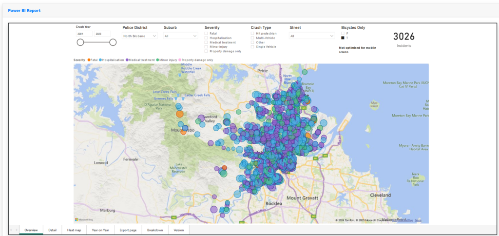
This is a map of cycling incidents from the Queensland Police dataset from 2001 to 2021. It includes only incidents attended by police so you can imagine that there are far more than shown here. This is a simple representation of the data in the Brisbane North Police Division to browse to get a feel for the volume and location of cycling related incidents and the nature of those incidents.

Case study
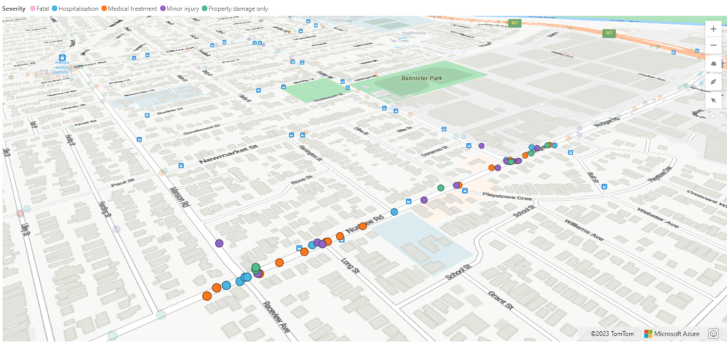
Nudgee Road between the Soorley Bikeway in the north to the Kingsford Smith Drive is a main route for commuters heading to the city from Brisbane’s northern suburbs. The QPS data set shows 30 incidents involving cyclists on this stretch of road. Between Manson and Gerler Roads, just a couple of hundred metres, is a cluster of incidents attributed to poor conditions including a narrow road, bike lanes with cars parked in them and very poor visibility at intersections. The school sits in the middle of this hot spot. Long Street has been the scene of two incidents in the past and now a fatality.
This is the area the Brisbane City Council has declared requires the coroner to advise on how to improve safety – and yet the evidence already exists that its long been a safety issue and the reasons are well known. The Brisbane North BUG along with other BUGs in the region are petitioning the council to make the necessary improvements to provide a safer environment for cyclists and indeed all road users there. If you want to help then click here.

Note: This is a subset of the opensource data set selecting only incidents involving bicycles for the North Brisbane Police Division. Source: Crash data from Queensland roads.
Police will need to attend only if: Death or injury (requiring medical attention from a qualified ambulance officer, nurse or doctor) occurs to any party involved.
In addition to the embedded viewer there is a Crash Database analytics tool available at the link below. This permits more detailed analysis of crashes and production of reports, useful for advocates making a case to support actual events on the street, highlighting blackspots and so forth. The information is supplied by the Queensland government as mentioned above so its unlikely to be disputed.
It is maintained annually, information is shown 12 months in arrears owing to the release of the data by the Queensland government. Use BikeCrash to login.