Issue
The Downfall Creek Principal Cycleway requires 5 discrete carriageway crossings simply in order to cross Gympie Road. A 4 stage crossing is available, but less usable due to path width and obstacles. Preferred route in red, alternative in cyan on Map 1 below.

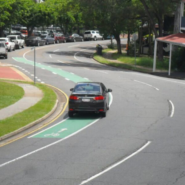
The new upgrade reduces the number of crossings, but may well increase wait times depending on how the lights are programmed. In addition, the proposed new bus layover opposite Murphy Road adds a new signalised crossing which will no doubt be constantly red for active transport users so busses can turn anytime and cyclists get a minute in every light cycle, if past experience is anything to go by. The preference here, I think, would be a raised priority wombat crossing a little in from Gympie Road to allow busses to fully turn into the facility before encountering a 90º interaction with active transport users, rather than users being on the Gympie Road path in a the large bus blind spot while it turns the corner.

The obvious solution is an underpass for people and wildlife, however, the last word was from some TMR engineers we met onsite to discuss at the end of last year. They said the old 1929 bridge that’s under there somewhere, or perhaps the concrete culverts made a new, higher bridge not feasible. The social and environmental benefits would be huge and worth a lot more than an extra lane each way.
Opportunities (Map 2)
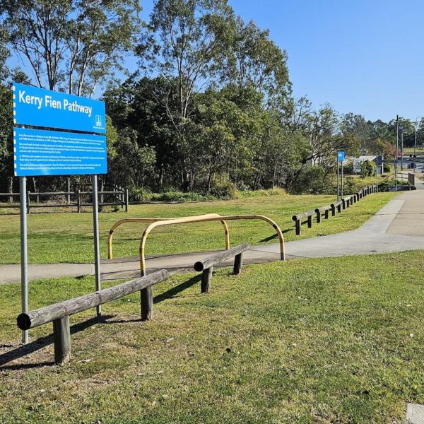
There is a strong active transport case for a higher bridge over Downfall Creek. The picture below shows how it can be done – this is a couple of kilometres north which Cabbage Tree Creek Bikeway goes under Gympie Road.

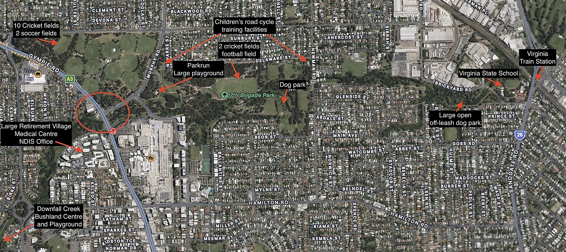
This would permit access to the facilities listed be low and on the map:
- Bicycle and other wheeled access across a major arterial road which is currently a 3 lanes each way and becoming 4 plus turning lanes
- Pedestrian and wheeled access to shopping and parks for
- Retirement villages, Cooper House and Parkview,
- Chermside Medical Centre,
- NDIS Government Offices,
- Wheller Gardens Wellbeing Centre,
- Houses and Apartment blocks,
- all separated from Westfield Chermside by 6 lanes of arterial road
- Pedestrian and other active transport access across Gympie Road for families playing sport at the 10 cricket fields and 2 soccer fields in Marchant Park, and 2 cricket fields and football fields in 7th Brigade Park
- Pedestrian access by dog walkers to 7th Brigade dog park and Brickyard Rd off leash dog park
- Safe active transport access to a large kids playground installation and to 2 children’s bicycle road training facilities
- Safe active transport access to Chermside Parkrun which starts on the corner of Murphy Road and Kittyhawk Drive.
- Active transport access to Virginia State School along Downfall Creek Cycleway for families cut off by Gympie Road
- Active access to Virginia Train Station along Downfall Creek for an area with no trains (West Chermside, Aspley, etc)
- Wildlife corridor Mountains to Mangroves. Many land-based native animals won’t travel through water, so have to cross the road to avoid the creek.

Solution and Benefits
A higher bridge over Downfall Creek would:
- Remove 5 (or 4) discrete traffic carriageways required to cross Gympie Road
- Safe road crossing for Mountains to Mangroves wildlife, separating them from traffic and providing a vegetated corridor rather than a concrete tunnel for them to travel through
- Safe and easy access to Chermside Shopping Centre and sporting facilities in Marchant and 7th Brigade Park for retirees, families and park users
- Safe and easy access for children to ride to Virginia State School along the Downfall Creek Principal Cycling Network
- Safe and easy access to Virginia Train Station for those who live in a train desert in West Chermside, Aspley, etc

Access for all, including wildlife, without risking lives or health crossing an arterial road.