Here are some thoughts on the North Brisbane Bikeway and the Olympics venues, as you prepare submissions to the state government before the 27 September deadline. The link for submissions is: Victoria Park Precinct Draft Legacy Plan | State Development, Infrastructure and Planning.
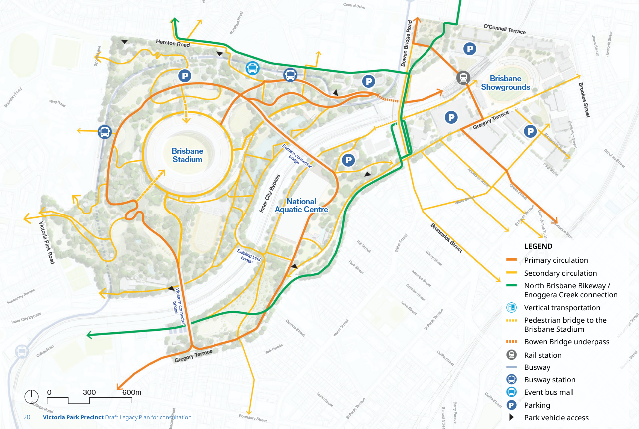
The Legacy master plan shows a thin green line noted in other diagrams as North Brisbane Bikeway (NBB). Let’s see what that thin green line could translate into in real life, and give some ideas for what to mention in your submission on the legacy plan.

The Department of Transport and Main Roads notes the NBB as a Priority Route on its Priority Route Maps. Indeed, it is shown as the highest priority, at Priority A (focus of delivery until 2027, based on the publication date of 2017). To quote TMR: “Principal routes form the spine to which local cycle networks connect. They are the most important routes for bike riders within a region.” (Ref 2). We will look at nearby connections (Priority B routes) and potential connections in another post.
First question: Shared or not?
Austroads recommends shared paths only “where there is a low number of pedestrians or cyclists and the use is not expected to be sufficiently great enough to provide separate facilities” (Ref 5).
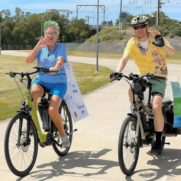
Separate bike and pedestrian paths also avoids the problems of the Government’s new 12km/hr limit around pedestrians on shared paths for pedal assist e-bike and scooter users and can therefore be used by more people.
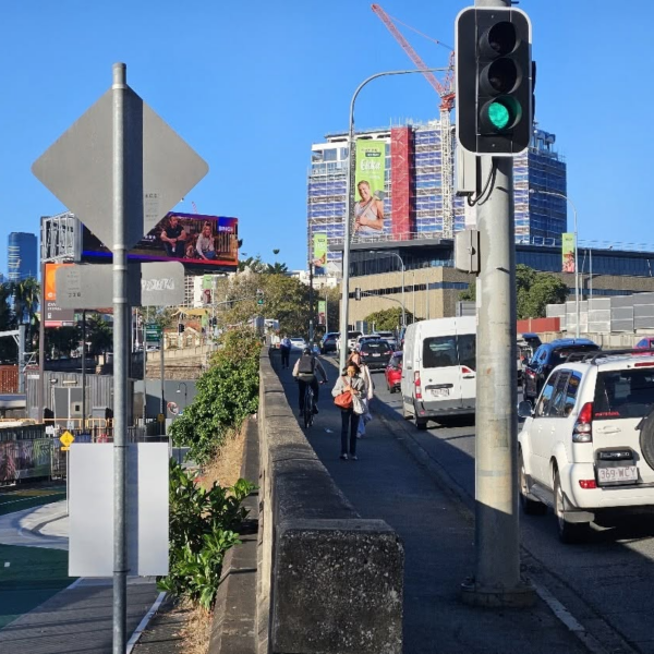
The current plans do not show any separated bike infrastructure within Barrambin itself. All infrastructure appears to be shared. This seems an odd choice given the volumes expected for events. The legacy plan does not encourage a north-south connection for cyclists. This is a big loss, given the proximity of Aberleigh Rd and the western arm of Enoggera Creek bikeway.
Let’s move on to the next question: What does the separated bikeway linking Roma St / the city with the existing NBB need to look like?
Stages 1-4 of the NBB north of the Barrambin site were completed from 2016 to 2021 as a bi-directional bikeway 4m wide with a separate pedestrian path 2m wide, and includes protected crossings.
This aligns with TMR guidelines which require a minimum 3m width for the current surveyed users of around 300 cyclists / scooters per hour during morning and afternoon peak at the existing Land Bridge to Barrambin in October of 2025 (Ref 3). No data newer than 2019 is available for the NBB itself at the previously active counter sites, but given that the Enoggera Creek Bikeway feeds into the NBB here, it is easy to see why TMR’s recommended 4m width for paths with 500+ users per hour were applied.
The Sylvan Rd bikeway project in Toowong is also a Priority A route and has just moved into the next design phase for a bi-directional bikeway 4m wide with separated pedestrian paths.
The precedent for a 4m wide bi-directional bikeway is pretty strong. So, is this the current plan?
A 4m wide bi-directional bikeway looks like this:

Case study: North Brisbane Bikeway—Stages 1 to 4
The artists’ impression in the legacy document appears to retain parking to the Gregory Terrace edge at the expense of bikeway width, with what looks like a 1.5m wide bi-directional bikeway.

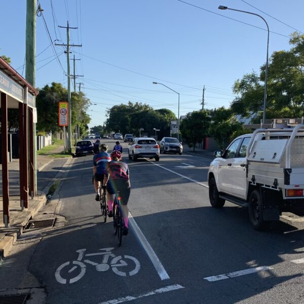
If the option for an on-road separated bikeway is instead followed, given the steep topography of Spring Hill Common / Victoria Park adjacent to Gregory Terrace, the TMR guidelines call for an additional physical separation of 1m width between the bike lanes and traffic, given that Gregory Terrace is a 60km/h limit (Ref 4). TMR uses Annerley Rd as a reference, although they’ve reduced the physical barrier here to the recommended absolute minimum of 40cm given the retrofitted nature of the bikeway.

The NBB link between the CBD and the northern suburbs via Barrambin is an opportunity to achieve best practice and maintain the precedent set by other existing (NBB) and imminent (Sylvan Rd) bikeway projects. In the absence of any other safe, separated connections to the Enoggera Creek bikeway or existing NBB through in Red Hill, Kelvin Grove, Spring Hill or the Valley, it makes or breaks the entire northern bikeway strategy.
If not done as part of a huge infrastructure project, then when?
The legacy plan needs to provide a 4m wide separated bikeway linking Roma St to the start of the NBB proper at Mann St, Windsor. As a Priority A corridor, a safe, separated bikeway should be prioritised in the design of entry plazas, pedestrian screening areas, vehicle loading zones and road design.
Ideally, there would also be a north-south bike connection through Barrambin. This is fodder for another post.
Meanwhile if you want to have your say, complete the survey linked to the button below.
1: Priority Route Maps, South East Queensland, Addendum to Principal Cycle Network Plan, Department of Transport and Main Roads, 2021
3: Brisbane City Council Bikeway Counts
4: TMR Guideline Selection and design of cycle tracks July 2025
5: Austroads, Guide to Road Design Part 6A Paths for Walking and Cycling, 2026